Sugar Creek June 3rd and 11th 2017 (10)
Created on: June 09, 2017
Upper 10 Mile trip with Clements Canoe Livery
Water at about 2 feet on the Crawfordsville, IN gauge.
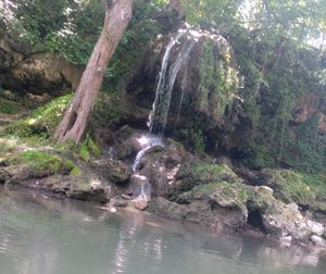
10 mi Clements Shuttles to just north of 32. The old Mill on right has nice .5 mi side hike up Mill Creek(Google Maps name) local name Spring Creek with 3 foot water fall at the end. Pine Hill Nature Preserve before the takeout is worth a side hike. Devil's Backbone trail has great views.
Map of Pine Hill Nature Preserve
https://www.in.gov/dnr/parklake/files/shades_pine_hills_np_trail_map.pdf
Yountsville Mill info
http://www.yountsvillemill.com/
-
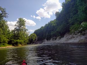
Right before Highway 32 Bridge on Sugar Creek
Right before Highway 32 Bridge on Sugar Creek
 Please wait...
-

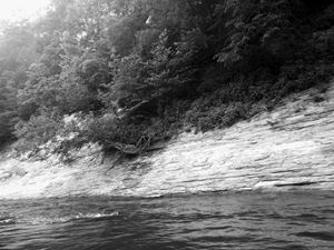
By Cold Spring Camp on Sugar Creek just before 8 mile mark
By Cold Spring Camp on Sugar Creek just before 8 mile mark
Please wait...
-
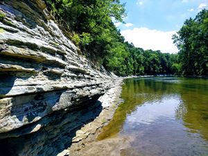
By Cold Spring Camp on Sugar Creek
By Cold Spring Camp on Sugar Creek
Please wait...
-
By Cold Spring Camp on Sugar Creek
By Cold Spring Camp on Sugar Creek
Please wait...
-

10 mi Clements Shuttles to just north of 32. The old Mill on right has nice .5 mi hike up Mill creek. Pine Hill before the takeout is worth a side hike. Devil Backbone trail has great views.
10 mi Clements Shuttles to just north of 32. The old Mill on right has nice .5 mi hike up Mill creek. Pine Hill before the takeout is worth a side hike. Devil Backbone trail has great views.
Please wait...
-
Please wait...
-
Looking down Sugar Creek from entrance of Karnes Creek which forms Lake Holiday to the East
Looking down Sugar Creek from entrance of Karnes Creek which forms Lake Holiday to the East
Please wait...
-

Pine Hills Nature Preserver looking up Indian Creek at were it flows into Sugar Creek.
Pine Hills Nature Preserver looking up Indian Creek at were it flows into Sugar Creek.
https://www.in.gov/dnr/parklake/files/shades_pine_hills_np_trail_map.pdf
Please wait...
-

Honeycomb Rock Pine Hills Nature Preserve
Honeycomb Rock Pine Hills Nature Preserve
http://www.in.gov/dnr/naturepreserve/files/np-PineHillsTrailGuide.pdf
Please wait...
-

3 foot waterfall at end of Mill Creek / Spring Creek hike by the old Youtsville Mill
3 foot waterfall at end of Mill Creek / Spring Creek hike by the old Youtsville Mill
Please wait...


